Microbial Source Tracking
Sampling a spread of points across a water body narrows where contamination is entering, rather than confirming that it has.
Explore MST
Extending spatial reach
TRACE-E 120 extends sampling and monitoring into open water, soft banks, industrial frontage and other difficult-to-access areas. Operated manually or along planned routes and transects, it collects samples and geospatial data across areas that are difficult to cover from the bank.
The problem
Which is not always the same as where the science requires. Access can shape sampling plans, so a lake may be sampled from the easiest bank and a route may follow where people can safely reach rather than where the question leads.
Reaching further out often means a boat and crew, turning a routine sample into a planned operation with additional cost, logistics and risk. That can limit how often spatial sampling is carried out.
There is also a gap between the sample points themselves. When teams move between locations on foot, little or no data is collected about the water body in between. TRACE-E can collect a continuous stream of geospatial and physicochemical data as it moves, adding environmental context between discrete or integrated sampling points.

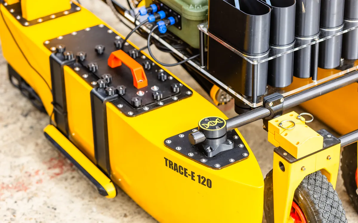

A remotely operated or route-driven surface vessel that extends sampling and monitoring across the water body.
Depending on the fitted payload, TRACE-E 120 can collect up to five 2-litre samples and return them for downstream processing. Sample positions can be assigned individually or grouped as field replicates.
As it moves between sampling points, TRACE-E can also collect geospatial and physicochemical data, building environmental context across the route rather than only at the discrete sample locations.
See it working
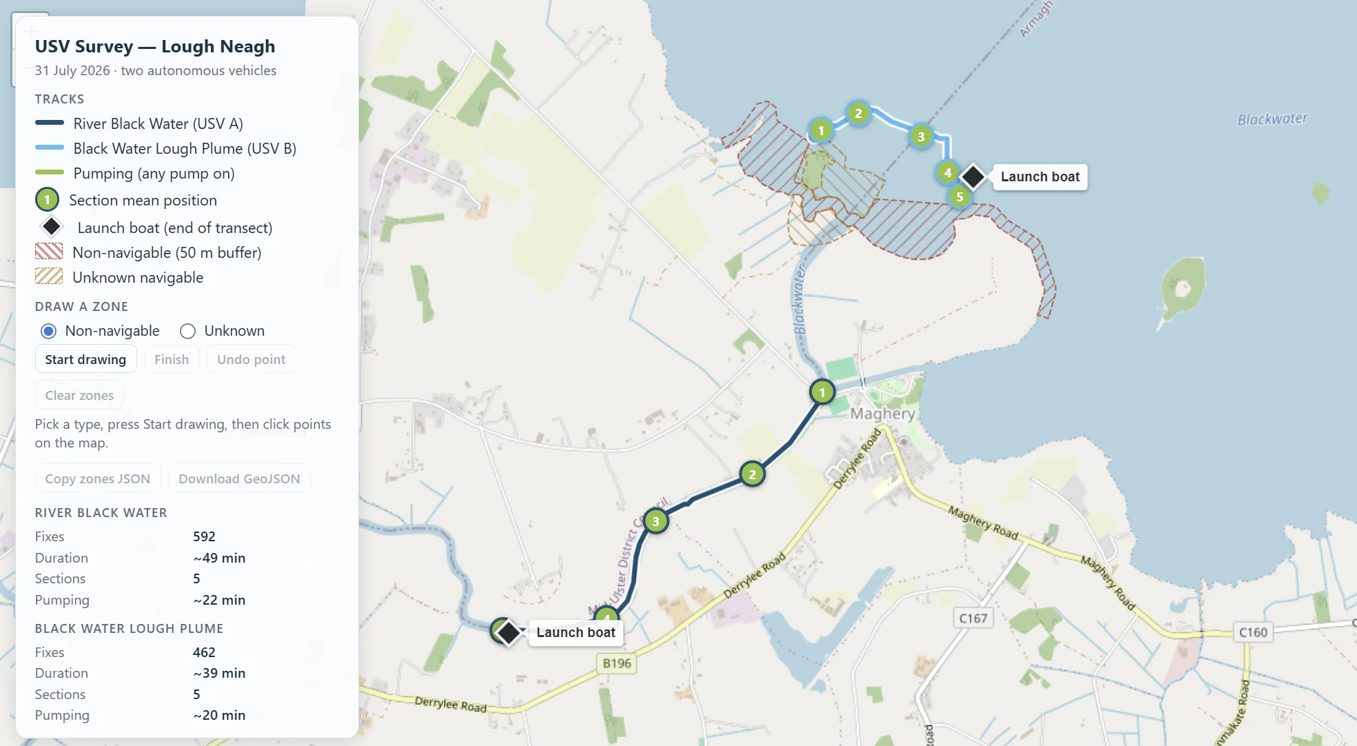
Launch from the bank, follow a planned route across open water, collect samples at defined points, then recover the vessel, with environmental and geospatial data logged throughout the mission.
A mission
TRACE-E can collect discrete samples at defined points or integrated samples across a route. Onboard instruments log physicochemical, geospatial and other sensor data throughout the mission, so each sample can be interpreted alongside the wider environmental context.
Mission data can then be uploaded to the EASI Dashboard for review, visualisation and analysis.
Want to reach further?
We can help determine whether TRACE-E is the right approach for extending spatial sampling and monitoring.
Where surveying is applied
Sampling a spread of points across a water body narrows where contamination is entering, rather than confirming that it has.
Explore MST
Establishing whether a species is present across a whole water body, including the margins and inlets a bankside survey never reaches.
Explore INNS
Repeatable transects across a lake or estuary, so a campaign can be compared season to season rather than site visit to site visit.
Explore solutions